Sold Oct 31, 2000
$750,000
$350,000
by Baycoast Bank
Mortgage Due Nov 01, 2036
Sold Sep 09, 1991
$3,666
Buyer
Seller
2032 Main Road in Westport Point, MA was first built in 1870 and is 154 years old.
Although, the building on the property was most recently renovated and altered in 1970.
This has been categorized as a residential property type.
For those interested in architecture, the building on the property was built in a historical style.
There are a total of 2 floors.
There are a total of 10 rooms in the home, of which, 4 are bedrooms.
2032 Main Road has 2,225 sqft of living area. This is typically the area of a building that is heated or air conditioned and does not include the garage, porch or basement square footage.
In total, the area measurement of the land is 13,983 square feet.
Learn more about the property and building on this page. The home has a gable style roof made of asphalt. Fun fact, did you know that buildings can move due to weather changes? That's why, the type of control joints used in the construction of your home is extremely important. Based on our data, we know that the home was built with brick control joints. The condition of the building has been evaluated as average. The exterior walls of the home are made of wood siding. As for heating, the home is utilizing a hot water heating system and being fueled with oil. There is a fireplace in the home! Just imagine how amazing it would be to curl up in front of a cozy fireplace during those chilly winter nights. Here at RealtyHop, we've focused a lot of our efforts into gathering up-to-date and accurate data for our users. Based on our sources, 2032 Main Road was last sold in Jan 1, 1970 for $750,000. According to our calculations, that's $337.08 per sqft. Prior to that sales transaction, the property was sold for $3,666 in Jan 1, 1970. Current property owners are expected to pay $9,275 in taxes per year. The property on 2032 Main Road was last assessed in 2024. As a result of that assessment, the total value of the property was placed at $1,199,900. To break that down further, the land itself was valued at $961,900. While improvements to the property were assessed at a total of $238,000. Based on our records, the total assessed value for this property has been marked as more than the total market value as of this moment. Which is pretty atypical. Are you already in the process of closing on a property and have signed a purchase agreement? You may want to consider locking in your current mortgage rate if interest rates have been rising or seem volatile. This is what's known in the market as a mortgage rate lock (aka rate protection). However, be sure to evaluate your situation carefully before you do so. There may be certain costs associated with taking this action and you'll want to time the start of your perfectly!This property is not listed for sale at this point in time but RealtyHop is constantly updating our inventory of available sales listings in real time. Don't want to miss out on this property? You can save the listing to your favorites by signing up for a RealtyHop account or you can check back frequently for updates.
Learn more about the property and building on this page. The home has a gable style roof made of asphalt. Fun fact, did you know that buildings can move due to weather changes? That's why, the type of control joints used in the construction of your home is extremely important. Based on our data, we know that the home was built with brick control joints. The condition of the building has been evaluated as average. The exterior walls of the home are made of wood siding. As for heating, the home is utilizing a hot water heating system and being fueled with oil. There is a fireplace in the home! Just imagine how amazing it would be to curl up in front of a cozy fireplace during those chilly winter nights. Here at RealtyHop, we've focused a lot of our efforts into gathering up-to-date and accurate data for our users. Based on our sources, 2032 Main Road was last sold in Jan 1, 1970 for $750,000. According to our calculations, that's $337.08 per sqft. Prior to that sales transaction, the property was sold for $3,666 in Jan 1, 1970. Current property owners are expected to pay $9,275 in taxes per year. The property on 2032 Main Road was last assessed in 2024. As a result of that assessment, the total value of the property was placed at $1,199,900. To break that down further, the land itself was valued at $961,900. While improvements to the property were assessed at a total of $238,000. Based on our records, the total assessed value for this property has been marked as more than the total market value as of this moment. Which is pretty atypical. Are you already in the process of closing on a property and have signed a purchase agreement? You may want to consider locking in your current mortgage rate if interest rates have been rising or seem volatile. This is what's known in the market as a mortgage rate lock (aka rate protection). However, be sure to evaluate your situation carefully before you do so. There may be certain costs associated with taking this action and you'll want to time the start of your perfectly!This property is not listed for sale at this point in time but RealtyHop is constantly updating our inventory of available sales listings in real time. Don't want to miss out on this property? You can save the listing to your favorites by signing up for a RealtyHop account or you can check back frequently for updates.
This property description is generated based on publicly available data.

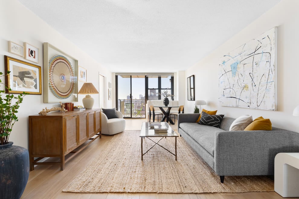
2032 Main Road, Westport Point, MA 02791
By proceeding, you consent to receive calls and texts at the number you provided, including marketing by autodialer and prerecorded and artificial voice, and email, from Move, Inc., Move Sales, Inc., Opcity, Inc., realtor.com, and their network of service providers, about your inquiry and other home-related matters, but not as a condition of any purchase. Msg/data rates may apply. This consent applies even if you are on a corporate, state, or national Do Not Call list.
By proceeding, you agree to our Terms of Service.